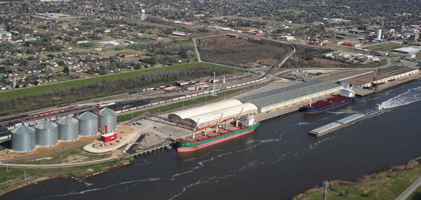
Port Arthur, Texas
Specifications and services
Location: Sabine-Neches Ship Channel – Gulf Intercoastal Waterway Mile Marker 285 (29°51’37.87″ N, 93°56’24.69″ W)
Size: 100 acres / 247 hectares
Water Depth: 40 feet / 12.2 meters
Berths & Length: 4 berths, measuring 3,210 feet / 978 meters; 1 berth for RoRo measuring 80 feet / 24 meters wide and 850 feet / 259 meters long
Cranes: 1 – 75 ton gantry crane
Truck Lanes & Scales: 2 gates, scales adjacent to facility
Rail Services: KCS with reciprocal switching or trackage rights with BNSF and UP
Highway Access: I-10 East and West
Cargos / Commodities Handled:
- Forest Products
- Steel Products
- General Cargo
- RoRo
- Military
Other facility facts
Heavy Lift Service: Water derrick available on request
Transit Shed: 5 measuring 512,500 square feet / 47,613 square meters total
Automated Appointment System: Telephonic appointment system
